33rd Street–Rawson Street station
33rd Street–Rawson Street (announced as simply 33rd Street on trains) is a local station on the IRT Flushing Line of the New York City Subway. It is located over Queens Boulevard on a concrete viaduct. It is served by the 7 train at all times.
33 Street–Rawson Street | ||||||||||||||||||||||||||||||||||||||||||||||||||||||||||||||||||||
|---|---|---|---|---|---|---|---|---|---|---|---|---|---|---|---|---|---|---|---|---|---|---|---|---|---|---|---|---|---|---|---|---|---|---|---|---|---|---|---|---|---|---|---|---|---|---|---|---|---|---|---|---|---|---|---|---|---|---|---|---|---|---|---|---|---|---|---|---|
 Platform view | ||||||||||||||||||||||||||||||||||||||||||||||||||||||||||||||||||||
| Station statistics | ||||||||||||||||||||||||||||||||||||||||||||||||||||||||||||||||||||
| Address | 33rd Street & Queens Boulevard Long Island City, NY 11101 | |||||||||||||||||||||||||||||||||||||||||||||||||||||||||||||||||||
| Borough | Queens | |||||||||||||||||||||||||||||||||||||||||||||||||||||||||||||||||||
| Locale | Sunnyside | |||||||||||||||||||||||||||||||||||||||||||||||||||||||||||||||||||
| Coordinates | 40°44′40.62″N 73°55′52.7″W | |||||||||||||||||||||||||||||||||||||||||||||||||||||||||||||||||||
| Division | A (IRT) | |||||||||||||||||||||||||||||||||||||||||||||||||||||||||||||||||||
| Line | IRT Flushing Line | |||||||||||||||||||||||||||||||||||||||||||||||||||||||||||||||||||
| Services | 7 | |||||||||||||||||||||||||||||||||||||||||||||||||||||||||||||||||||
| Transit | ||||||||||||||||||||||||||||||||||||||||||||||||||||||||||||||||||||
| Structure | Elevated | |||||||||||||||||||||||||||||||||||||||||||||||||||||||||||||||||||
| Platforms | 2 side platforms | |||||||||||||||||||||||||||||||||||||||||||||||||||||||||||||||||||
| Tracks | 3 | |||||||||||||||||||||||||||||||||||||||||||||||||||||||||||||||||||
| Other information | ||||||||||||||||||||||||||||||||||||||||||||||||||||||||||||||||||||
| Opened | April 21, 1917 | |||||||||||||||||||||||||||||||||||||||||||||||||||||||||||||||||||
| Station code | 460[1] | |||||||||||||||||||||||||||||||||||||||||||||||||||||||||||||||||||
| Accessible | not ADA-accessible; accessibility planned | |||||||||||||||||||||||||||||||||||||||||||||||||||||||||||||||||||
| Opposite- direction transfer | Yes | |||||||||||||||||||||||||||||||||||||||||||||||||||||||||||||||||||
| Former/other names | Rawson Street | |||||||||||||||||||||||||||||||||||||||||||||||||||||||||||||||||||
| Traffic | ||||||||||||||||||||||||||||||||||||||||||||||||||||||||||||||||||||
| 2019 | 2,907,388[2] | |||||||||||||||||||||||||||||||||||||||||||||||||||||||||||||||||||
| Rank | 171 out of 424[2] | |||||||||||||||||||||||||||||||||||||||||||||||||||||||||||||||||||
| Station succession | ||||||||||||||||||||||||||||||||||||||||||||||||||||||||||||||||||||
| Next north | 40th Street–Lowery Street: 7 | |||||||||||||||||||||||||||||||||||||||||||||||||||||||||||||||||||
| Next south | Queensboro Plaza: 7 | |||||||||||||||||||||||||||||||||||||||||||||||||||||||||||||||||||
| ||||||||||||||||||||||||||||||||||||||||||||||||||||||||||||||||||||
| ||||||||||||||||||||||||||||||||||||||||||||||||||||||||||||||||||||
| ||||||||||||||||||||||||||||||||||||||||||||||||||||||||||||||||||||
| ||||||||||||||||||||||||||||||||||||||||||||||||||||||||||||||||||||


History
The Flushing Line was opened from Queensboro Plaza to Alburtis Avenue (now 103rd Street–Corona Plaza) on April 21, 1917, with a local station at 33rd Street.[3]
The platforms at 33rd Street were extended in 1955–1956 to accommodate 11-car trains.[4]
In December 2019, the Metropolitan Transportation Authority announced that this station would become ADA-accessible as part of the agency's 2020–2024 Capital Program.[5]
Station layout
| P Platform level | ||
| Side platform | ||
| Southbound local | ← | |
| Peak-direction express | ← | |
| Northbound local | | |
| Side platform | ||
| M | Mezzanine | Fare control, station agent, MetroCard machines |
| G | Street level | Entrances/exits |
The station has two side platforms and three tracks. The center track is used by peak-direction <7> express trains during rush hours.
In 1998, the name "Rawson" was removed from the station signs and subway maps. It was restored in 2004 as part of a historical move when the local community decided to commemorate the deceased local Rawson Hart Boddam.
Exits
Both exits are under the tracks in the median of Queens Boulevard. The full-time exit is at 33rd Street, with two stairs from each platform, and the part-time exit is at 34th Street, also with two stairs from each platform. The part-time exit has a crossunder to allow free transfers between opposite directions while the full-time one does not, even though it has the layouts that could allow one.[6]
Image gallery
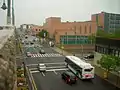 View of Queens Boulevard from the 33rd Street station
 Mezzanine
 7 train stopped at the platform
References
- "Station Developers' Information". Metropolitan Transportation Authority. Retrieved June 13, 2017.
- "Facts and Figures: Annual Subway Ridership 2014–2019". Metropolitan Transportation Authority. 2020. Retrieved May 26, 2020.
- "Transit Service on Corona Extension of Dual Subway System Opened to the Public". The New York Times. April 22, 1917. p. RE1. Retrieved October 2, 2011.
- Authority, New York City Transit (1955). Minutes and Proceedings.
- "Press Release - MTA Headquarters - MTA Announces 20 Additional Subway Stations to Receive Accessibility Improvements Under Proposed 2020-2024 Capital Plan". MTA. December 19, 2019. Retrieved December 20, 2019.
- "MTA Neighborhood Maps: Long Island City" (PDF). Metropolitan Transportation Authority. 2015. Retrieved September 27, 2015.
External links
| Wikimedia Commons has media related to 33rd Street – Rawson Street (IRT Flushing Line). |
- nycsubway.org – IRT Flushing Line: 33rd Street/Rawson Street
- Station Reporter — 7 Train
- The Subway Nut — 33rd Street–Rawson Street Pictures
- MTA's Arts For Transit — 33rd Street–Rawson Street (IRT Flushing Line)
- 33rd Street entrance from Google Maps Street View
- 34th Street entrance from Google Maps Street View
- Platforms from Google Maps Street View
| |
| |
| Flushing Line |
|
|---|---|
| |