Fleury-les-Aubrais
Fleury-les-Aubrais is a commune in the Loiret department in north-central France.
Fleury-les-Aubrais | |
|---|---|
 Town hall and church | |
.svg.png.webp) Coat of arms | |
Location of Fleury-les-Aubrais 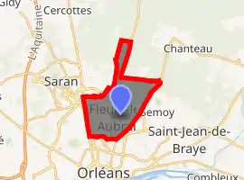
| |
 Fleury-les-Aubrais  Fleury-les-Aubrais | |
| Coordinates: 47°57′04″N 1°52′28″E | |
| Country | France |
| Region | Centre-Val de Loire |
| Department | Loiret |
| Arrondissement | Orléans |
| Canton | Fleury-les-Aubrais |
| Intercommunality | Orléans Métropole |
| Government | |
| • Mayor (2020–2026) | Carole Canette[1] |
| Area 1 | 10.12 km2 (3.91 sq mi) |
| Population (2017-01-01)[2] | 21,026 |
| • Density | 2,100/km2 (5,400/sq mi) |
| Time zone | UTC+01:00 (CET) |
| • Summer (DST) | UTC+02:00 (CEST) |
| INSEE/Postal code | 45147 /45400 |
| Elevation | 109–133 m (358–436 ft) (avg. 125 m or 410 ft) |
| 1 French Land Register data, which excludes lakes, ponds, glaciers > 1 km2 (0.386 sq mi or 247 acres) and river estuaries. | |
As a part of German-occupied France, its railway station was destroyed in 1944 by the Combined Bomber Offensive.
See also
References
- "Répertoire national des élus: les maires". data.gouv.fr, Plateforme ouverte des données publiques françaises (in French). 2 December 2020. Retrieved 11 December 2020.
- "Populations légales 2017". INSEE. Retrieved 6 January 2020.
External links
| Wikimedia Commons has media related to Fleury-les-Aubrais. |
- Official website (in French)
| Authority control |
|
|---|
This article is issued from Wikipedia. The text is licensed under Creative Commons - Attribution - Sharealike. Additional terms may apply for the media files.