Pirkkala
Pirkkala (Swedish: Birkala) is a municipality of Finland. It is located some 10 kilometres (6 mi) south-west from Tampere in the Pirkanmaa region. The municipality has a population of 19,838 (31 July 2020)[3] and covers an area of 104.04 square kilometres (40.17 sq mi) of which 22.66 km2 (8.75 sq mi) is water.[2] The population density is 243.77 inhabitants per square kilometre (631.4/sq mi), which make it the most densely populated municipality in Finland, which does not use the title of town or city. Also, Pirkkala is currently the fastest-growing municipality in the Pirkanmaa region.[7] The municipality is unilingually Finnish.
Pirkkala
Birkala | |
|---|---|
Municipality | |
| Pirkkalan kunta Birkala kommun | |
 Tampere-Pirkkala Airport | |
 Coat of arms | |
 Location of Pirkkala in Finland | |
| Coordinates: 61°28′N 023°39′E | |
| Country | |
| Region | Pirkanmaa |
| Sub-region | Tampere sub-region |
| Charter | 1922 |
| Government | |
| • Mayor | Marko Jarva[1] |
| Area (2018-01-01)[2] | |
| • Total | 104.04 km2 (40.17 sq mi) |
| • Land | 81.38 km2 (31.42 sq mi) |
| • Water | 22.66 km2 (8.75 sq mi) |
| Area rank | 304th largest in Finland |
| Population (2020-07-31)[3] | |
| • Total | 19,838 |
| • Rank | 58th largest in Finland |
| • Density | 243.77/km2 (631.4/sq mi) |
| Population by native language | |
| • Finnish | 97.5% (official) |
| • Swedish | 0.4% |
| • Others | 2.2% |
| Population by age | |
| • 0 to 14 | 22.1% |
| • 15 to 64 | 65.9% |
| • 65 or older | 12% |
| Time zone | UTC+02:00 (EET) |
| • Summer (DST) | UTC+03:00 (EEST) |
| Municipal tax rate[6] | 20% |
| Website | www.pirkkala.fi |
Tampere-Pirkkala Airport is located in southwest Pirkkala. The most significant main road in Pirkkala is Tampere Ring Road.
History
The former parish of Suur-Pirkkala (Great Pirkkala) is mentioned in historical writings from the 14th century. It occupied over half of Pirkanmaa, a region nowadays populated by about 360,000 inhabitants. Suur-Pirkkala began to split when new parishes and municipalities were founded. In 1922 the remains of Suur-Pirkkala were split into Pohjois- (Northern) and Etelä-Pirkkala (Southern Pirkkala). In 1938 the name of Northern Pirkkala was changed to Nokia and Southern Pirkkala reverted to its original name.
The present-day region of Pirkanmaa is named after Pirkkala.
Gallery
 Pirkkala Municipal Ofiice
 Veska Shopping Centre
 Baushaus store in Pirkkala
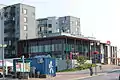 Pirkkala Public Library
 Old Church of Pirkkala
 Naistenmatka suburb along Suupantie
See also
References
- "Municipal administration - The Mayor". Pirkkala.fi. Retrieved 25 December 2019.
- "Area of Finnish Municipalities 1.1.2018" (PDF). National Land Survey of Finland. Retrieved 30 January 2018.
- "Suomen virallinen tilasto (SVT): Väestön ennakkotilasto [verkkojulkaisu]. Heinäkuu 2020" (in Finnish). Statistics Finland. Retrieved 13 September 2020.
- "Population according to language and the number of foreigners and land area km2 by area as of 31 December 2008". Statistics Finland's PX-Web databases. Statistics Finland. Retrieved 29 March 2009.
- "Population according to age and gender by area as of 31 December 2008". Statistics Finland's PX-Web databases. Statistics Finland. Retrieved 28 April 2009.
- "List of municipal and parish tax rates in 2011". Tax Administration of Finland. 29 November 2010. Retrieved 13 March 2011.
- Pirkkala kiihdyttää kasvua, Tampereen kauppakamarilehti 1/2005 (in Finnish)
- "Networks, town twinning and partnerships" (PDF). City of Solna. Archived from the original (PDF) on 2016-04-02. Retrieved 2013-08-04.
External links
![]() Media related to Pirkkala at Wikimedia Commons
Media related to Pirkkala at Wikimedia Commons
- Municipality of Pirkkala – official site
| Municipalities |  | |
|---|---|---|
| Former municipalities |
| |