Saint-Méard
Saint-Méard (Occitan: Sent Mèrd) is a commune in the Haute-Vienne department in the Nouvelle-Aquitaine region in west-central France.
Saint-Méard | |
|---|---|
 The Échizadour Tower, in Saint-Méard | |
Location of Saint-Méard 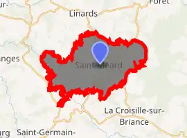
| |
 Saint-Méard  Saint-Méard | |
| Coordinates: 45°39′57″N 1°32′57″E | |
| Country | France |
| Region | Nouvelle-Aquitaine |
| Department | Haute-Vienne |
| Arrondissement | Limoges |
| Canton | Eymoutiers |
| Intercommunality | Briance Combade |
| Government | |
| • Mayor (2008–2014) | Henri Lavaud |
| Area 1 | 24.51 km2 (9.46 sq mi) |
| Population (2017-01-01)[1] | 357 |
| • Density | 15/km2 (38/sq mi) |
| Time zone | UTC+01:00 (CET) |
| • Summer (DST) | UTC+02:00 (CEST) |
| INSEE/Postal code | 87170 /87130 |
| Elevation | 330–560 m (1,080–1,840 ft) |
| 1 French Land Register data, which excludes lakes, ponds, glaciers > 1 km2 (0.386 sq mi or 247 acres) and river estuaries. | |
Geography
The river Briance flows northwestward through the western part of the commune.
References
- "Populations légales 2017". INSEE. Retrieved 6 January 2020.
| Wikimedia Commons has media related to Saint-Méard. |
| Authority control |
|---|
This article is issued from Wikipedia. The text is licensed under Creative Commons - Attribution - Sharealike. Additional terms may apply for the media files.