Vire-Normandie
Vire-Normandie (French pronunciation: [viʁ nɔʁmɑ̃di]) is a commune in the Calvados department and Normandy region of north-western France.
Vire-Normandie | |
|---|---|
Subprefecture and commune | |
 The lock, the church and surroundings in Vire | |
Location of Vire-Normandie 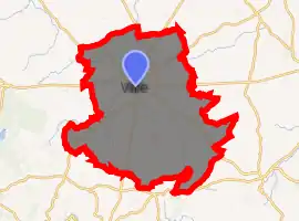
| |
 Vire-Normandie  Vire-Normandie | |
| Coordinates: 48°50′17″N 0°53′20″W | |
| Country | France |
| Region | Normandy |
| Department | Calvados |
| Arrondissement | Vire |
| Canton | Vire |
| Government | |
| • Mayor (2014–2020) | Marc Andreu-Sabater |
| Area 1 | 138.52 km2 (53.48 sq mi) |
| Population (2017-01-01)[1] | 17,178 |
| • Density | 120/km2 (320/sq mi) |
| Time zone | UTC+01:00 (CET) |
| • Summer (DST) | UTC+02:00 (CEST) |
| INSEE/Postal code | 14762 /14500 |
| 1 French Land Register data, which excludes lakes, ponds, glaciers > 1 km2 (0.386 sq mi or 247 acres) and river estuaries. | |
It was established on 1 January 2016 as a result of the merger of the former communes of Vire (seat of the new municipality), Coulonces, Maisoncelles-la-Jourdan, Roullours, Saint-Germain-de-Tallevende-la-Lande-Vaumont, Truttemer-le-Grand, Truttemer-le-Petit and Vaudry.[2]
Vire-Normandie is the administrative centre (chef-lieu) of the arrondissement of Vire.
See also
References
| Wikimedia Commons has media related to Vire Normandie. |
- "Populations légales 2017". INSEE. Retrieved 6 January 2020.
- Arrêté préfectoral 31 December 2015 (in French)
This article is issued from Wikipedia. The text is licensed under Creative Commons - Attribution - Sharealike. Additional terms may apply for the media files.