Castelbiague
Castelbiague is a commune in the Haute-Garonne department in southwestern France.
Castelbiague | |
|---|---|
 The road into Castelbiague | |
Location of Castelbiague 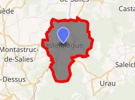
| |
 Castelbiague  Castelbiague | |
| Coordinates: 43°02′14″N 0°55′31″E | |
| Country | France |
| Region | Occitanie |
| Department | Haute-Garonne |
| Arrondissement | Saint-Gaudens |
| Canton | Bagnères-de-Luchon |
| Intercommunality | Cagire Garonne Salat |
| Government | |
| • Mayor (2008–2014) | Pierre Braquet |
| Area 1 | 5.84 km2 (2.25 sq mi) |
| Population (2017-01-01)[1] | 251 |
| • Density | 43/km2 (110/sq mi) |
| Time zone | UTC+01:00 (CET) |
| • Summer (DST) | UTC+02:00 (CEST) |
| INSEE/Postal code | 31114 /31160 |
| Elevation | 334–702 m (1,096–2,303 ft) (avg. 376 m or 1,234 ft) |
| 1 French Land Register data, which excludes lakes, ponds, glaciers > 1 km2 (0.386 sq mi or 247 acres) and river estuaries. | |
Population
| Year | Pop. | ±% |
|---|---|---|
| 1962 | 204 | — |
| 1968 | 205 | +0.5% |
| 1975 | 208 | +1.5% |
| 1982 | 210 | +1.0% |
| 1990 | 205 | −2.4% |
| 1999 | 209 | +2.0% |
| 2008 | 227 | +8.6% |
References
- "Populations légales 2017". INSEE. Retrieved 6 January 2020.
| Wikimedia Commons has media related to Castelbiague. |
| Authority control |
|---|
This article is issued from Wikipedia. The text is licensed under Creative Commons - Attribution - Sharealike. Additional terms may apply for the media files.