Gémozac
Gémozac is a commune in the Charente-Maritime department in southwestern France.
Gémozac | |
|---|---|
 The church of Saint-Pierre in Gémozac | |
.svg.png.webp) Coat of arms | |
Location of Gémozac 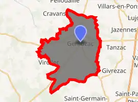
| |
 Gémozac  Gémozac | |
| Coordinates: 45°34′11″N 0°40′29″W | |
| Country | France |
| Region | Nouvelle-Aquitaine |
| Department | Charente-Maritime |
| Arrondissement | Saintes |
| Canton | Saintonge Estuaire |
| Intercommunality | Gémozac et Saintonge Viticole |
| Government | |
| • Mayor (2008–2014) | Loïc Girard |
| Area 1 | 31.93 km2 (12.33 sq mi) |
| Population (2017-01-01)[1] | 2,851 |
| • Density | 89/km2 (230/sq mi) |
| Time zone | UTC+01:00 (CET) |
| • Summer (DST) | UTC+02:00 (CEST) |
| INSEE/Postal code | 17172 /17260 |
| Elevation | 17–48 m (56–157 ft) |
| 1 French Land Register data, which excludes lakes, ponds, glaciers > 1 km2 (0.386 sq mi or 247 acres) and river estuaries. | |
Population
| Year | Pop. | ±% |
|---|---|---|
| 1821 | 2,461 | — |
| 1831 | 2,590 | +5.2% |
| 1836 | 2,607 | +0.7% |
| 1841 | 2,610 | +0.1% |
| 1846 | 2,663 | +2.0% |
| 1851 | 2,675 | +0.5% |
| 1856 | 2,626 | −1.8% |
| 1861 | 2,787 | +6.1% |
| 1866 | 2,792 | +0.2% |
| 1872 | 2,598 | −6.9% |
| 1876 | 2,709 | +4.3% |
| 1881 | 2,693 | −0.6% |
| 1886 | 2,578 | −4.3% |
| 1891 | 2,503 | −2.9% |
| 1896 | 2,506 | +0.1% |
| 1901 | 2,625 | +4.7% |
| 1906 | 2,614 | −0.4% |
| 1911 | 2,621 | +0.3% |
| 1921 | 2,368 | −9.7% |
| 1926 | 2,444 | +3.2% |
| 1931 | 2,378 | −2.7% |
| 1936 | 2,358 | −0.8% |
| 1946 | 2,333 | −1.1% |
| 1954 | 2,152 | −7.8% |
| 1962 | 2,194 | +2.0% |
| 1968 | 2,236 | +1.9% |
| 1975 | 2,388 | +6.8% |
| 1982 | 2,381 | −0.3% |
| 1990 | 2,333 | −2.0% |
| 1999 | 2,356 | +1.0% |
| 2008 | 2,588 | +9.8% |
References
- "Populations légales 2017". INSEE. Retrieved 6 January 2020.
| Wikimedia Commons has media related to Gémozac. |
| Authority control |
|
|---|
This article is issued from Wikipedia. The text is licensed under Creative Commons - Attribution - Sharealike. Additional terms may apply for the media files.