Saint-Martin-d'Uriage
Saint-Martin-d'Uriage is a commune in the Isère department located in the French Alps, in southeastern France. The nearest major city is Grenoble.
Saint-Martin-d'Uriage | |
|---|---|
 A general view of Saint-Martin-d'Uriage | |
 Coat of arms | |
Location of Saint-Martin-d'Uriage 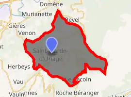
| |
 Saint-Martin-d'Uriage  Saint-Martin-d'Uriage | |
| Coordinates: 45°09′08″N 5°50′21″E | |
| Country | France |
| Region | Auvergne-Rhône-Alpes |
| Department | Isère |
| Arrondissement | Grenoble |
| Canton | Oisans-Romanche |
| Intercommunality | CC Le Grésivaudan |
| Government | |
| • Mayor (2014–2020) | Gérald Giraud |
| Area 1 | 29.69 km2 (11.46 sq mi) |
| Population (2017-01-01)[1] | 5,451 |
| • Density | 180/km2 (480/sq mi) |
| Time zone | UTC+01:00 (CET) |
| • Summer (DST) | UTC+02:00 (CEST) |
| INSEE/Postal code | 38422 /38410 |
| Elevation | 320–2,200 m (1,050–7,220 ft) |
| 1 French Land Register data, which excludes lakes, ponds, glaciers > 1 km2 (0.386 sq mi or 247 acres) and river estuaries. | |
Population
| Year | Pop. | ±% |
|---|---|---|
| 1793 | 1,916 | — |
| 1806 | 1,896 | −1.0% |
| 1821 | 2,171 | +14.5% |
| 1831 | 2,454 | +13.0% |
| 1841 | 2,591 | +5.6% |
| 1851 | 2,400 | −7.4% |
| 1861 | 2,234 | −6.9% |
| 1872 | 2,253 | +0.9% |
| 1881 | 2,165 | −3.9% |
| 1891 | 2,023 | −6.6% |
| 1901 | 1,784 | −11.8% |
| 1911 | 1,630 | −8.6% |
| 1921 | 1,407 | −13.7% |
| 1931 | 1,314 | −6.6% |
| 1946 | 1,293 | −1.6% |
| 1954 | 1,659 | +28.3% |
| 1962 | 1,354 | −18.4% |
| 1968 | 1,511 | +11.6% |
| 1975 | 1,815 | +20.1% |
| 1982 | 2,527 | +39.2% |
| 1990 | 3,678 | +45.5% |
| 1999 | 4,794 | +30.3% |
| 2006 | 5,147 | +7.4% |
| 2011 | 5,460 | +6.1% |
See also
References
- "Populations légales 2017". INSEE. Retrieved 6 January 2020.
| Wikimedia Commons has media related to Saint-Martin-d'Uriage. |
| Authority control |
|
|---|
This article is issued from Wikipedia. The text is licensed under Creative Commons - Attribution - Sharealike. Additional terms may apply for the media files.